Category:Maps of Niue
Jump to navigation
Jump to search
Countries of Oceania: Australia · Fiji · Federated States of Micronesia · Kiribati · Marshall Islands · Nauru · New Zealand · Palau · Papua New Guinea · Samoa · Solomon Islands · Tonga · Tuvalu · Vanuatu
Other areas: American Samoa · Clipperton Island · Cocos (Keeling) Islands · Cook Islands · French Polynesia · Guam · Hawaii · New Caledonia · Niue · Norfolk Island · Northern Mariana Islands · Pitcairn Islands · Tokelau · Wallis and Futuna – Partly: British overseas territories · Overseas France · Indonesia · French Southern and Antarctic Lands · United States Minor Outlying Islands
Other areas: American Samoa · Clipperton Island · Cocos (Keeling) Islands · Cook Islands · French Polynesia · Guam · Hawaii · New Caledonia · Niue · Norfolk Island · Northern Mariana Islands · Pitcairn Islands · Tokelau · Wallis and Futuna – Partly: British overseas territories · Overseas France · Indonesia · French Southern and Antarctic Lands · United States Minor Outlying Islands
Wikimedia category | |||||
| Upload media | |||||
| Instance of | |||||
|---|---|---|---|---|---|
| Category combines topics | |||||
 | |||||
Subcategories
This category has the following 8 subcategories, out of 8 total.
Media in category "Maps of Niue"
The following 45 files are in this category, out of 45 total.
-
Niue 2022.png 5,000 × 5,915; 2.51 MB
-
Administrative map of Niue mk.svg 1,766 × 2,002; 134 KB
-
Carte topographique de Niue.svg 1,760 × 2,005; 332 KB
-
Diplomatic missions in Niue.svg 940 × 415; 1.43 MB
-
Diplomatic missions of Niue.svg 940 × 415; 1.43 MB
-
Diplomatic Relations Niue.PNG 1,425 × 625; 57 KB
-
ECDM 20160216 TC.pdf 1,625 × 1,125; 583 KB
-
ECDM 20160218 TC.pdf 1,625 × 1,125; 729 KB
-
ECDM 20200117 TC TINO.pdf 1,625 × 1,125; 616 KB
-
European Union Niue Locator.svg 638 × 328; 1.7 MB
-
Flag Map Of New Zealand And His Territories.png 462 × 711; 54 KB
-
Foreign relations of Niue.svg 940 × 415; 1.43 MB
-
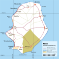
Hakupu Niue.png 1,024 × 1,024; 75 KB
-
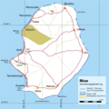
Hikutavake Niue.png 1,024 × 1,024; 75 KB
-
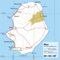
Lakepa Niue.png 1,024 × 1,024; 75 KB
-
Liku Niue.png 1,024 × 1,024; 75 KB
-
Makefu Niue.png 1,024 × 1,024; 75 KB
-
Mutalau Niue.png 1,024 × 1,024; 75 KB
-
Namukulu Niue.png 1,024 × 1,024; 75 KB
-
Niue carte administrative-fr.svg 1,766 × 2,002; 134 KB
-
Niue carte foret-fr.svg 1,760 × 2,006; 205 KB
-
Niue criopped from Plans in the South Pacific Ocean 1951 US nautical chart + modern borders.svg 2,878 × 3,190; 10.39 MB
-
Niue DNI Solar-resource-map GlobalSolarAtlas World-Bank-Esmap-Solargis.png 1,842 × 2,573; 414 KB
-
Niue EEZ division.svg 850 × 876; 93 KB
-
Niue EEZ.svg 850 × 876; 179 KB
-
Niue GHI Solar-resource-map GlobalSolarAtlas World-Bank-Esmap-Solargis.png 1,842 × 2,573; 409 KB
-
Niue map (PG).jpeg 400 × 400; 53 KB
-
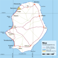
Niue Verwaltungsgliederung.png 1,024 × 1,024; 87 KB
-
Niue ZEE.png 396 × 362; 4 KB
-
Niue-locator-map.png 240 × 305; 8 KB
-
Niue-topo50-maps + modern borders.svg 5,671 × 8,505; 7.26 MB
-
Niue-topo50-maps.jpg 5,671 × 8,505; 5.28 MB
-
Niue2022OSM.png 2,409 × 2,820; 1.19 MB
-
Pacific Ocean laea Oceanian countries map.jpg 1,165 × 1,070; 542 KB
-
PAT - Niue.gif 800 × 1,090; 64 KB
-
Samoa, Tonga and Fiji Map.png 3,440 × 2,372; 783 KB
-
Tamakautoga Niue.png 1,024 × 1,024; 75 KB
-
Toi Niue.png 1,024 × 1,024; 75 KB
-
Tuapa Niue.png 1,024 × 1,024; 75 KB
-
Vaiea Niue.png 1,024 × 1,024; 75 KB
-
Карта Ніуэ.svg 1,760 × 2,006; 205 KB
-
Карта Ниуэ.svg 1,000 × 1,200; 217 KB
-
Округа Ниуэ.svg 1,721 × 2,000; 271 KB
-
Физичка карта на Ниуе.svg 1,760 × 2,005; 332 KB


