As of Friday morning, there are nine active wildfires burning in California, which have killed 28 people and left thousands without homes.
Why It Matters
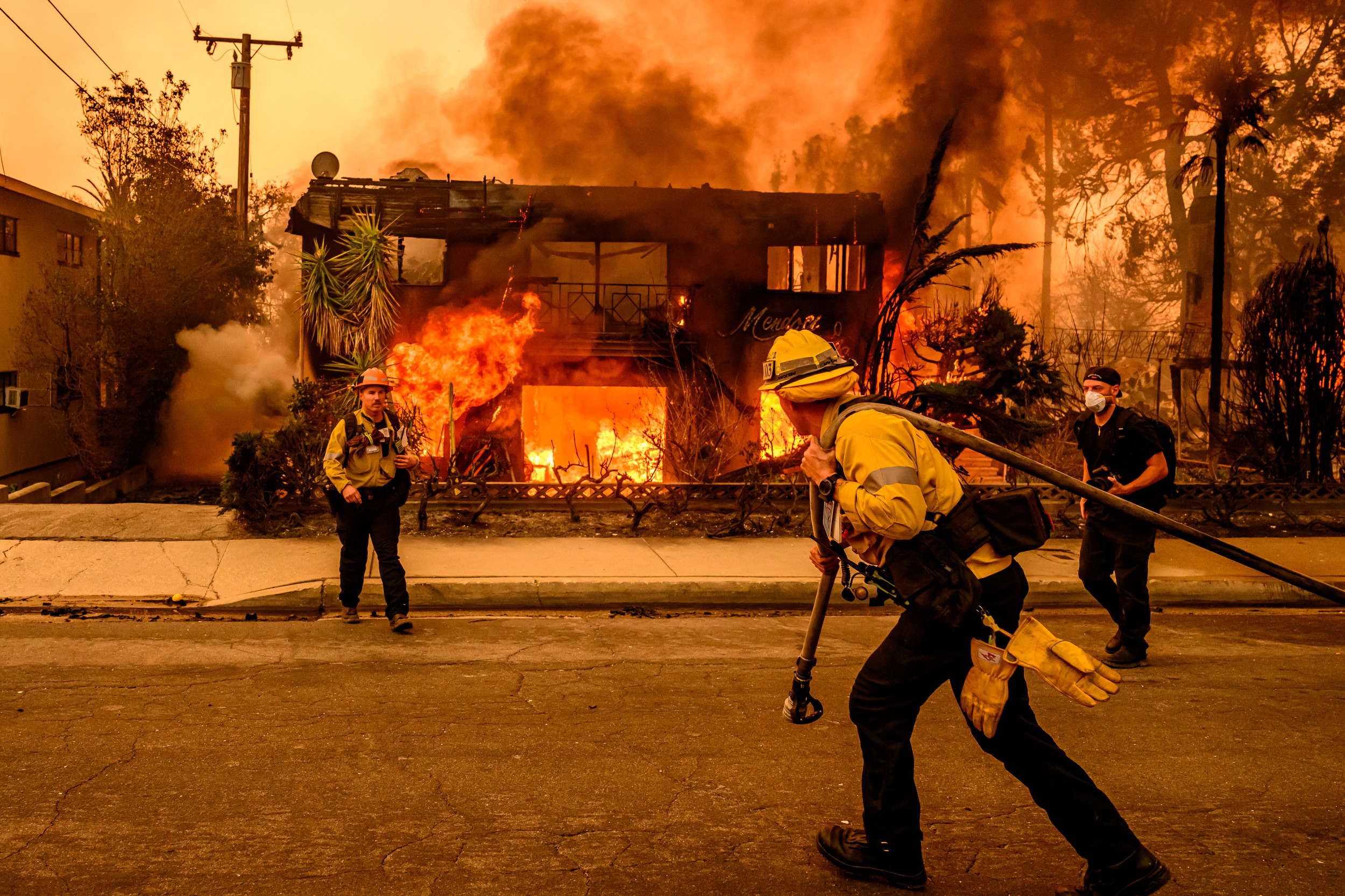
The wildfires continue to burn across LA, threatening thousands of people and their homes. New fires erupted yesterday, spreading across hundreds of acres in just hours.
The weather is also bad this week, with a red flag warning in place, meaning a further high risk of wildfires.

What To Know
Strong winds returned this week, leading meteorologists to issue red flag warnings advising people of critical fire weather.
Firefighters have made significant progress fighting the largest wildfires in Southern California.
Fig Fire

The Fig fire ignited on Thursday evening on the 41000 block of Fig Street in Riverside County, spreading to nearby vegetation.
Evacuation orders were initially issued for the area surrounding I-15 and Jefferson Avenue, from Guava Street to French Valley Parkway in Murrieta. However, the order was then reduced to include only the areas between Guava Street and Elm Street.
Additional evacuation warnings have been issued for four other neighborhoods in southern Murrieta.
Fire officials have confirmed that the fire's forward progress has been halted and there is no immediate threat to areas outside the evacuation zones.
Border 2 Fire

The Border 2 fire, which broke out on the U.S.-Mexico border in San Diego County on Thursday, has grown to 600 acres and is at 0% containment, according to the California Department of Forestry and Fire Protection (Cal Fire). In an earlier update, the department said the blaze had a "dangerous rate'' of spread.
No evacuations have been ordered due to the Border 2 fire, which is currently burning in the Otay Mountain Wilderness area, but Cal Fire said "there is a threat to critical communication infrastructure on Otay Mountain Repeater Site."
As of Friday morning, the fire is not thought to pose a threat to any homes.
Hughes Fire

The Hughes fire ignited on Wednesday and quickly exploded to more than 10,000 acres, forcing tens of thousands of people to evacuate.
As of Friday morning, the fire is 36% contained. Approximately 31,000 people are currently under mandatory evacuation orders, while another 23,000 are under evacuation warnings.
The National Weather Service (NWS) extended a red flag warning until Friday morning for most of Los Angeles and Ventura counties as winds push through the area.
Los Angeles County Sheriff Robert Luna said the Hughes fire was being fed by high winds and dry conditions.
Palisades Fire

Firefighters are still working to contain Los Angeles County's Palisades fire, which began on January 7. So far, the fire has spread across more than 23,000 acres and is 75% contained.
Officials have confirmed that 6,810 structures have been destroyed and 941 damaged. The inferno has killed at least 11 people so far.
A red flag warning of critical fire danger is in place for much of the Los Angeles area until 10 a.m. on Friday thanks to continued gusty winds and extremely low humidity.
Santa Ana winds with gusts ranging from 45-55 mph were observed in the area on Thursday, according to Cal Fire. A curfew continues to be in effect nightly from 6 p.m. to 6 a.m. in the mandatory evacuation areas in the Palisades.
Eaton Fire

At more than 14,000 acres, the Eaton fire is the second-largest wildfire burning in Southern California. It is 95 percent contained. The blaze is also burning in Los Angeles County.
So far, the fire has destroyed more than 9,000 structures and damaged more than 1,000. Meanwhile, 17 people have died as a result of the Eaton fire.
A red flag warning will persist through early Friday, with briefly gusty northeast winds on Friday night creating critical conditions at high elevations, according to Cal Fire.
A cold front is expected to bring at least light rain this weekend.
Clay Fire

The Clay fire in Riverside County, near Los Angeles, began on Tuesday evening and has grown to nearly 40 acres. The fire is burning near Pedley Road and Van Buren Boulevard in Jurupa Valley.
As of Friday morning, it is 85 percent contained. The cause of the fire remains under investigation.
An evacuation warning was lifted for residents south of Limonite Avenue between Van Buren Boulevard and Beach Street at 11 p.m. on Tuesday, according to the county fire department. There are currently no evacuation orders in place.
Sepulveda Fire

The Sepulveda fire ignited on Thursday and is burning in Los Angeles County, having spread across 45 acres. So far, it is 60 percent contained.
Fire officials have confirmed that the fire's forward progress has been halted. No evacuation orders are currently in place after they were lifted on Thursday.
Laguna Fire

The Laguna fire ignited in Ventura County on Thursday and has grown to 94 acres.
Evacuation warnings are still in place in Laguna zones 1 and 2, with a potential threat to life, according to Cal Fire. As of Friday morning, the fire is 70% contained.
Meanwhile, all roads closed due to the fire have been reopened. The University Glen campus is also open, but classes remain canceled.
Fire officials have confirmed that the fire's forward progress has been halted.
Gibbel Fire

The Gibbel fire was first reported at around 4:40 p.m. on Thursday at the 28000 Block of Silver Dew Drive in the City of Hemet and has since grown to 20 acres.
Multiple air and ground resources stopped the forward progress of the fire at 15 acres, Cal Fire said in an update. It is currently 60 percent contained.
What People Are Saying
NWS said: "Dangerous fire weather conditions will persist through Friday as fuels remain extremely dry and ready to burn.
"Any fire that starts can grow fast and out of control. Have a plan, especially if you are in a high fire risk area."
What Happens Next
The windy conditions will continue this week, according to multiple weather alerts and warnings from NWS offices in the area.
fairness meter


About the writer
Martha McHardy is a U.S. News reporter based in London, U.K. Her focus is on U.S. politics and polling. She ... Read more