The morning after…

I’d hung around St. Helier to watch Middlesbrough F.C. play in the Championship final on the tv. Long story short, Middlesbrough lost the game and one thing led to another resulting in waking up the following morning feeling a little jaded.


Well stocked with liquids, I caught the bus from St. Helier to La Corbière on the south east tip of the island.

Arriving at La Corbière. The sky was cloudless and there wasn’t a whisper of a breeze. It was fairly obvious that there was to be no let-up in the heatwave.

Prior to my trip to Jersey, I’d been quite keen to visit some of the WWII concrete Atlantic wall installations. The Frederich Tamms designed structures had influenced the brutalist designs of the nineteen sixties. However, my visit to the Forced Labour memorial at La Hougue Bie had altered my perspective on these structures. Faced with the reality of how these structures were built, the term brutalist had taken on taken a different meaning.
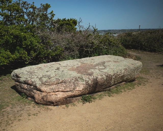
I walked inland, following the bed of an old railway, to take a look at a large pink granite slab known as La Table des Marthes. The slab is thought to be the capstone of a Neolithic dolmen and was discovered in 1850. Originally the slab had been supported at each end by pillars of stone and earth. Pottery, burned stones and broken stone axes were also found. The structure was destroyed in 1899 during the construction of a railway.

From La Table des Marthes I followed the footpath down to Petit Port Beach and then climbed up through the dusty scrubland to look for a monument known as La Sergentè
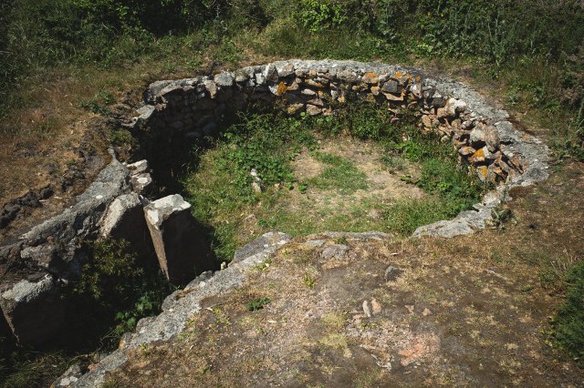
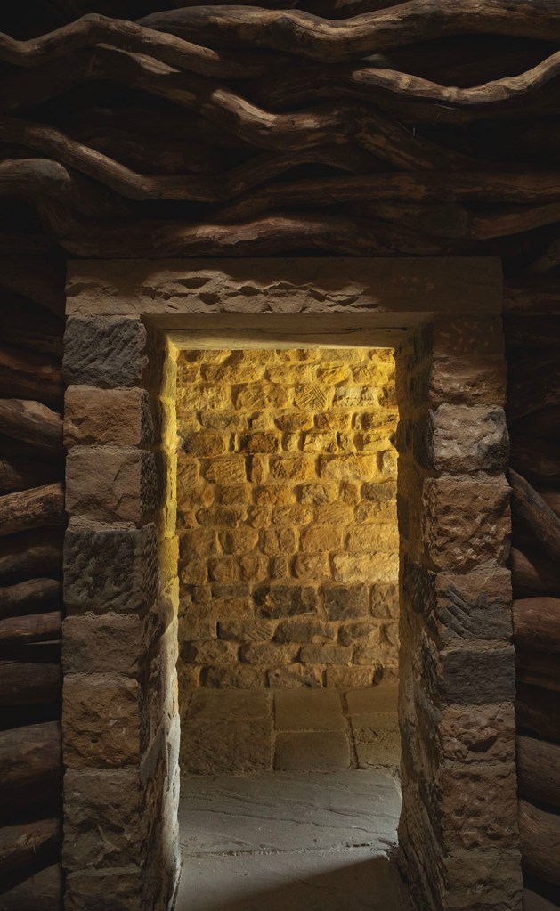
La Sergentè is a dry stone wall lined circular chamber approximately three meters in diameter. The entrance to the chamber is via a short passage lined with upright stones and paved with granite slabs. The structure dates to the Early Neolithic making it one of the earliest monuments on the island.
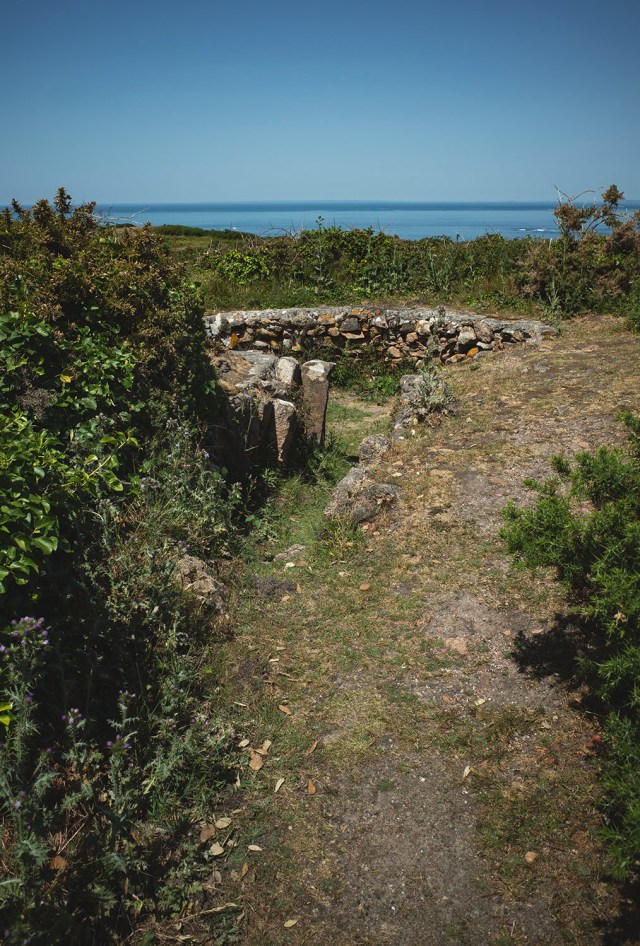
The design of the chamber is unique in the Channel Islands however similar structures have been found in Northern France. When excavated, four early Neolithic pottery vessels were discovered along with a substantial amount of rubble from what is believed to be a corbeled roof. The structure was originally covered with an earth mound.

I had planned to walk along the coast to a couple of sites located in the scrubland further north. Hiking during the hottest part of the day during a heatwave is not my idea of fun. I decided to call it quits and return to St. Helier and visit the excellent Société Jersiaise museum.

During my brief visit to Jersey I was fortunate to visit a number of lovely places. Hopefully, one day I’ll return to the Channel Islands and visit a few more.

Activism & The Old Woman Stone

The Old Woman Stone on Bamford Moor High Peak Derbyshire

In December 1931 this lovely Bronze Age 2.4m standing stone was deliberately broken and thrown down by the owners of the grouse moor to prevent it from being used as a waymarker by walkers.

In April 1932, Benny Rothman led the mass trespass of Kinder Scout in Derbyshire. The mass trespass followed an unsuccessful legal campaign to gain public access to the moors.

The owners of the Derbyshire grouse moors fiercely resisted any attempts to walk across their land and walkers were frequently attacked by gamekeepers with dogs.

During the mass trespass, the walkers were attacked by the landowners employees and violent scuffles broke out resulting in a number of activists being arrested sent to prison.

The mass trespass was a deliberate act of working class mass civil disobedience. The public outcry and support for the trespassers that followed helped pave the way to greater public access to the countryside.

In 2026 in England, the public still only have a right to roam over 8% of the countryside.

Right to Roam

Kirk Merrington

‘Merrington church stands at the east end of the village, and, from its elevated situation, is one of the most conspicuous land-marks in the county of Durham. The Norman portion of it is of great antiquity, being coeval in style with that of Jarrow’ The History and Antiquities of the County Palatine of Durham.

Pevsner described the church at Kirk Merrington as ‘one of the most interesting Norman churches in the County‘. On approaching it, I thought it looked a little odd, the tower looked too tall, the nave roof too steeply pitched, to my eye the proportions look a bit odd but then again, this is a Victorian reconstruction.

The present church was built in 1850 and incorporates a number of features salvaged from the original church including the doorway.

My visit was an impromptu one, I was in the area and saw the name on a sign so thought I’d check it out. Had I researched the church prior to my visit I’d have learned that the church is in the hands of the National Churches Trust and is open every second Tuesday of the month. So unfortunately for my visit, the church was locked. There was still plenty to see on the outside. I was particularly impressed by the Victorian corbel tables. The rebuild and attention to detail is quite impressive, I’ll definitely be coming back to take a look inside.

Sources

The History and Antiquities of the County Palatine of Durham by William Fordyce. 1857

The Buildings of England. County Durham by Nikolaus Pevsner 1953

The National Churches Trust

La Hougue Bie

Vorfreude – noun – German – Joyful anticipation

In the late 1990’s I was reading a book on European megaliths and saw a picture of a large mound with a pair of ancient chapels on its summit, beneath the mound was a large neolithic passage grave. The site was called was called La Hougue Bie and was situated on the island of Jersey. In the mid-90’s I had visited and been impressed by another mound-church-passage grave called the St. Michel tumulus in Brittany, this site looked even better, so Jersey was added to my ever-growing list of places to visit.

At the back end of 2016 a low budget airline advertised a bunch low-cost flights from Teesside to Jersey for the following year. I immediately booked a return fare and began collecting guidebooks from on-line auction sites to prepare for my trip. 2017 rolled around and the budget airline decided not to run the service. With no other reasonably priced options available at the time I postponed my visit to the island.

A few months ago I received an email from an airline offering low price flights to Jersey from Leeds, I jumped at the chance and grabbed a couple of tickets.

On the morning of my flight, the weather at home was cold and drizzly so I packed my small bag with some warm clothing and a water-proof coat. As we were flying south, the weather system that brought us May’s heatwave moved in from the Atlantic. Stepping off the plane at Jersey airport I was hit by an unexpected wall of heat. It was thirty degrees in the Channel Islands and I was dressed for the dreich north east of England.

The following day my priority was a visit to La Hougue Bie. It was only mid-morning and temperatures were rising up towards the thirties. The bus ride from my base in St. Helier to La Hougue took about 20 minutes. Unlike many things in Jersey, the buses aren’t expensive and thankfully, this one was air conditioned.

There’s a fee to enter the site but it’s good value, this place is the islands showcase of prehistory. There’s a very good museum which, amongst other things, proudly displays the Grouville Hoard , the largest celtic coin hoard ever found. There are also and a number of other features on site including some rescued stone settings from around the islands, a reconstructed Neolithic long house, a lovely cafe and a rather moving memorial to the captives who were brought to the Channel Islands by the nazis and used as forced labour.

Walking around the base of the huge mound topped with its ancient chapels and then arriving the entrance to the passage grave was quite thrilling, it was everything that I had anticipated with the added bonus of having the place to myself. Mark Paton describes the monument as ‘ one of the finest passage chambers in the whole of western Europe. The structure is over twenty metres in length , making it one of the the largest in existance, and it is covered by a twelve metre high mound, crowned by two medieval chapels.’

I had to crawl into the passage on my knees, a small bird had built a nest just inside the entrance, a tiny chick peered out at me. After a metre or two the roof gradually began to rise and the temperature became a lot cooler.

The long passage leads to an oval chamber. There are two side chambers that are opposite to each other and a third side chamber at the end of the monument. There are a number of carvings on the stones, the carvings are very subtle and I had forgotten to take a note of their locations so I was only able to find the cup-marked stone.

After spending some time looking at the longhouse and visiting the forced labour memorial, I started walking towards the coast and to have a look at the passage grave of La Pouquelaye de Faldouet. The tree-lined rural lanes provided some welcome shade from the midday sun and a light pleasant breeze was blowing in from the coast, it was all rather wonderful.

Arriving at the passage grave I spent a little time sitting in the chamber, enjoying the shade and the sound of the countryside around me.

After the passage grave I followed the lanes in search of a bus back to St. Helier. A path led towards the coastal village of Gorey, at a bend in the path I was met by this view.

It had taken me a decade to get here, the wait was worth it.

Sources

Jersey in Prehistory by Mark Paton. 1987

La Hougue Bie plan – Postcard by Société Jersiaise

Urban Megaliths

The megalithic complex of Ville-ès-Nouaux is located in St. Andrew’s Park on the outskirts of St. Helier. The site is close to the sea and was originally covered by sand dunes. It was discovered in 1869 when stones were uncovered during quarrying operations and was fully excavated in 1883 by Bellis and Cable. The excavations revealed a gallery-grave and a cist with stone circle. In addition, a cinary urn, a cairn and two other cists were found.

Hanging Stones – Andy Goldsworthy

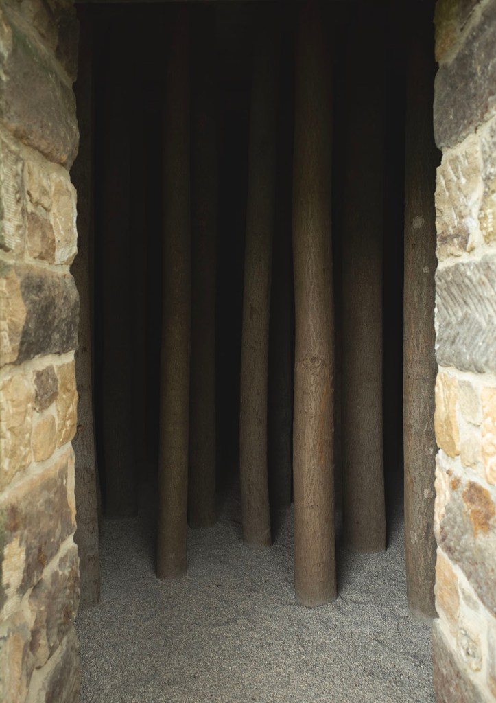
My friend Martyn was fortunate enough to be given some tickets to visit Andy Goldsworthy’s Hanging Stones. The number of people that can visit the artwork on a daily basis is limited, so when Martyn invited Graeme and I to join him we were up for it.

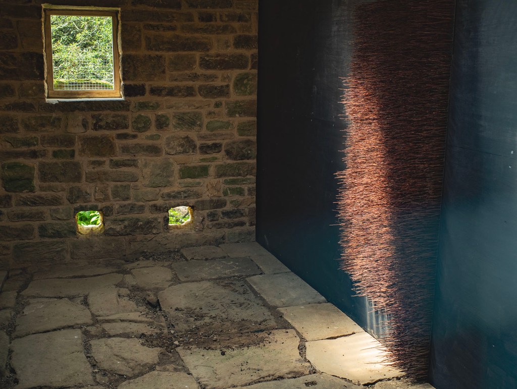
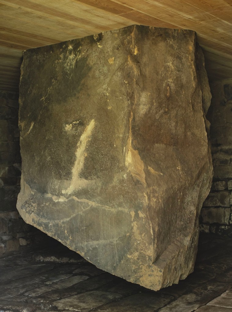
Hanging Stones has been conceived by Goldsworthy as a single artwork – the walk between each building is as much a part of the artwork as the buildings themselves. Nine buildings have been completed: Southfield HouseHanging Stone HouseSugget SpringJob’s WellHither HouseBogs HouseEbenezerNorthdale Head House (Dowson’s House) and Red House.’ The Hanging Stones

There is a tenth building Heygate Thorns, which is still a work in progress. All of the buildings are locked. Prior to commencing the walk, you are given a map, a set of instructions and a key to open the locked buildings. There are no written explanations of the artwork, the instructions only contain the route and a few points of navigation. Receiving the key feels special in itself, an act of trust.

The artwork is located in North Dale, a fairly short a valley running north from Rosedale Abbey to Rosedale Moor. The valley has no through road, just farm access tracks, a public footpath and a permissive footpath for visitors to the artwork. The land is primarily farmland and small woods with moorland encroaching on the higher ground.

There are also signs of previous industrial use from when Rosedale was a major centre of ironstone mining ’the Yorkshire Klondyke. A hundred years ago these valleys would have been full of the sounds of heavy industry and smoke from the mine engines. The scars on the landscape have now softened, reclaimed by nature.

For me, the artwork felt almost spiritual. Unlocking and entering each building felt like entering a shrine. Walking between the sites allowed time to reflect and anticipate. The walk took us through meadows, onto moorland, across a narrow rocky gorge, so much in such a small area.

In a world where information is instantly available it is rather beautiful to come to a place that feels outside of the everyday, questions are left unanswered, the experience is everything.

I could write about the wonderful conversations that sparked between us during our walk but I’ll spare you that and just say that we all felt more than a little overwhelmed by the whole experience.

If all of this sounds a little sombre, I can assure you that it wasn’t. It was quite the opposite, it was joyous. We laughed and joked our way around and finished our walk with a couple of pints in a Rosedale beer garden. I know that I’ll probably be thinking about this day for some time to come.

Ilkley – Some Old Stones and a Goddess

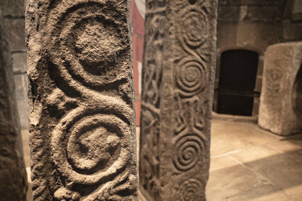
‘Verbia is often equated with Brighid, the Irish goddess, a.k.a. Bridget, Bride, Brid or Brig – possibly the origins of Brigantia, the goddess of the Brigantes. Bride’s Day is Imbolc, 1st of February, or when the ewes start to lactate. A goddess who heralds the coming warmth of spring…

…The Latin for spring is ver, from which our ‘vernal, ‘verdigris (green rust on copper) and ‘verdant’ (fresh, green) come. A botanical term ‘vernation’, refers to the arrangment of leaves in a bud. This derives from the Latin vernatio: The flouishing renewal of plants in spring, and the snakes sloughing of skin in spring. All of these spring-associated Latin words stem from the Indo-germanic root √WES, meaning “to shine”.

From – The Goddess in Wharfdale. Archaeologies of Consciousness. Essays in Experimental Prehistory. Gyrus. 2007 also available here

Wandering the Sikes and Slacks of Fylingdales

Sneaton Corner – Robin Hood’s Bay Road – Nigh Middle Sike – Middle Rigg – Far Middle Sike – Low Moor – Gray Heugh Slack – Biller Howe Dale Slack – John Cross Rigg

From when I left home to when I arrived at the at Sneaton Corner, on the edge of Flyingdales Moor, there was steady drizzling rain. Just after I arrived at the moor, the rain stopped and the sun came out from behind the clouds. The warm sunlight hitting the damp moor caused a low mist to rise and drift across the blackened ground. Graeme and I stood and watched, within a couple of minutes the mist disappeared.

We set off across the moor following the Robin Hood’s Bay Road, also known as The Old Salt Road and The Fish Road. The road is a series of deeply rutted hollow-ways that run diagonally across this part of the moor. In the past this was the route followed by carts carrying blocks of salt and baskets of fish from the coast to Saltergate and then onwards to the vale of Pickering and beyond.

As we moved onto the moor we came across a large block of a rock known locally as ganister or white flint. Ganister is a silca-rich rock that was much prized by iron and steel makers. The quarried stone was crushed and made into refractory bricks which were used to line the internal surfaces of blast furnaces.

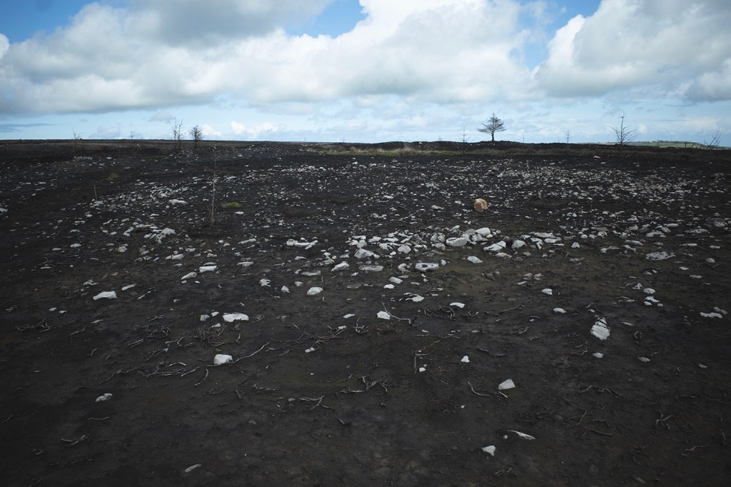
We left the old road and walked across the moor to look for prehistoric remains in the areas where the recent fire had burned through the peat to reveal the stoney surface beneath.

Old OS maps of this area show lots of Tumuli located right across the moor but we were only able to located couple. The missing cairns are a bit of a mystery, were they removed during WWII when the area was used for military training? or were the surveyors from the OS mistaken?

We noticed what appears to be a large roughly circular enclosure quite close to the Cross Dykes, this structure does not appear on the OS maps. I’m guessing that this structure was probably buried beneath the peat and heather when the OS surveyors visited the moor.

I spotted a couple of pieces of flints sticking out of the charred peat. Graeme suggested that we should see if the two fragments fit together. They did, a lovely Late Neolithic/Early Bronze Age barbed and tanged arrowhead.

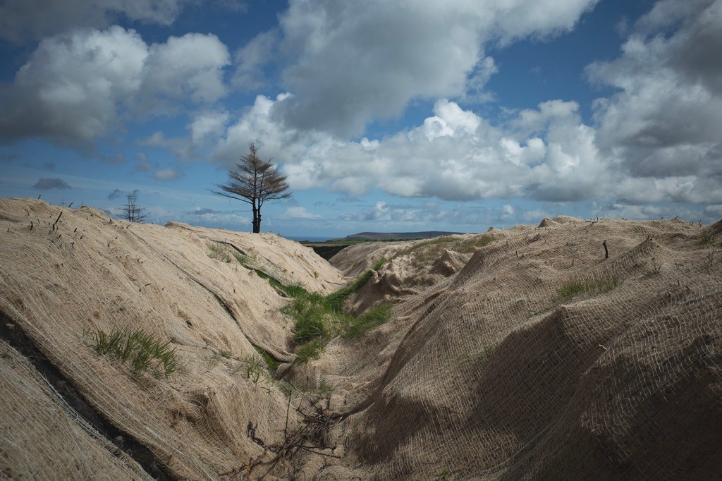
This was my third visit to the moor since last years fire. The coir matting that has been used to protect one short section of the prehistoric dykes is starting to do its job. Grass has taken root beneath the coir which will hopefully stabilise the banks of the dyke and prevent further erosion.

Parts of the moor are starting to show signs of regeneration but other areas of the moor are not doing so well, the peat has gone and it appears as if there have been little if any attempts to re-seed and stabilise these areas as was done after the catastrophic fire in 2004 on the Stoup Brow Moor. I suspect that the national park and landowners may not have the resources and funding that were available in 2004. Hopefully I’ll return in a month or so to see if anything has changed.

Sike a small stream or gulley

Slack a shallow area or depression between two areas of rising ground.

Map Source